MIOS · Marine Intelligence OS

Your boat is talking.
Now you can listen.

MIOS records every trip, every reading, every mile, and turns it into something you can actually use. No new screens and no rip-and-replace. Just a smarter helm.

It plugs in. It listens. It never talks back.

Deckhand is a small device that plugs straight into your boat's NMEA 2000 network, the same backbone your chartplotter and engine already use. It runs on bus power, so there's no extra wiring and no batteries.

Once it's connected, Deckhand listens to everything on the network: engine RPM, temperatures, fuel, depth, speed and GPS. It sends all of that to MIOS, which logs every trip and turns the raw numbers into something you can read.

It just listens. It doesn't change anything on your network, and your Garmin, Yamaha or Lowrance setup works exactly as before.

  1. 01

    NMEA 2000 backbone

    The network your chartplotter, engines and sensors already share.

  2. 02

    Deckhand

    Plugs into a spare tee on bus power and listens to every reading.

  3. 03

    MIOS

    Every trip logged and readable afterward.

    • RPM
    • °F
    • Depth ft
    • SOG kn
    • GPS

Ask your boat what happened out there.

Journal is a thread on top of trips you already logged. You ask in plain English; MIOS answers from measured NMEA 2000 and GPS—then attaches the charts and maps that back it up. The examples below are from one real August outing on the VPS history store.

1 · After you dock

One question, summary plus proof.

Open the Journal tab and ask about a trip—no menu diving. The reply is prose you can read on the dock, with attachments underneath: a measured speed chart for the hours you care about, and a marine-chart map for the same window.

Charts use the same channel colors as replay—motion for speed, depth, temperature when you ask for them. Maps are ENC soundings and contours with your track painted on top, not a stock photo of someone else’s harbor.
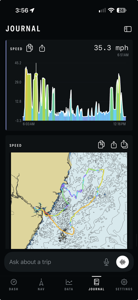
MIOS Journal on iPhone with a measured speed chart from about 6 AM to past noon and a map attachment in the same thread
Speed chart + map in one scroll · pinch to zoom either attachment

2 · The whole day

See the outing at chart scale.

Ask to see the whole trip and Journal renders the full GPS track on a nautical chart. Here the line is colored by speed over ground—cooler hues when you were idle in the river, warmer tones on the long offshore run and the turns back in.

That loop is roughly six hours on the water: out of the inlet, east into deeper water, back through the same mouth. The server caches each render so a follow-up question about another hour does not redraw the entire ocean.

Full-day trip on a marine chart with the track colored by speed from harbor to offshore and return
Aug 8 outing · speed ramp · full trip on ENC

3 · One hour

Narrow the window, keep the math.

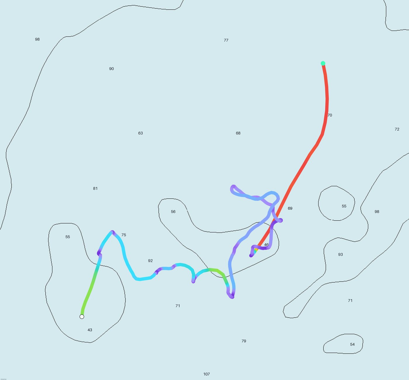
Questions often land on a slice of the day—“what was late morning like?” or “show me that hour on the chart.” Journal fits the map to that start and end time only, still measured, still with soundings in feet.

The track below is the same trip with a tighter crop: you can read bottom contours against where the boat actually went, not a generic screenshot.

Journal trip map window with speed-colored track over depth soundings
Windowed map · soundings and contours under the track

4 · Read the bottom

Zoom until the question is answered.

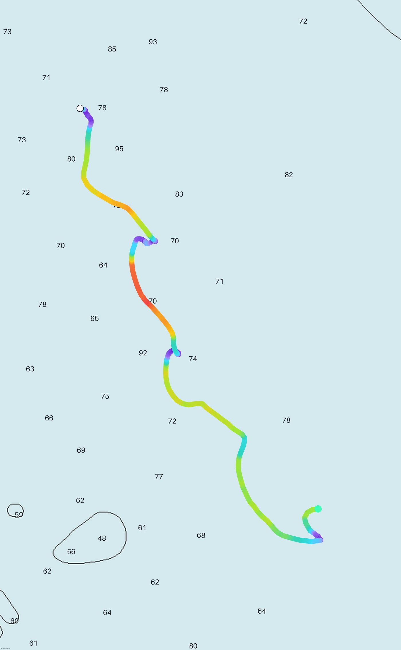
Pinch-zoom in the app; on the web you see the same idea—one passage where speed color and shoal lines tell you whether you had room. Journal can attach this when you ask about depth, speed, or “what happened along this leg.”

High-resolution exports for printing use the same geometry with sharper chart linework. Beta Deckhand kits focus on logging; Journal is already in the app for phones syncing trip history to MIOS.

Close-up Journal map colored by speed on a chart excerpt with shoal lines
Closer crop · same measured window, more chart detail

How we built MIOS · internal docs on /mios

Ten kits for boaters who want in early.

We're building 10 beta kits, and we're looking for boaters who want in early. Each kit includes a hand-built Deckhand and full access to MIOS.

They're working prototypes with spliced wiring and no fancy enclosure, but they live behind your console where nobody sees them anyway. In return, we ask you to run it on real trips and tell us what works, what doesn't and what you wish it did.

How to get one: fill out a short application about your boat and electronics. We review applications in the order they come in, and the first 10 boats that are a good fit get an invite to buy a kit. Everyone else goes on the waitlist for the next batch.

Apply for a beta kit.

About two minutes. Tell us about your boat and electronics.

You
Boat
Network and use
Does the boat have a working NMEA 2000 network? required

No payment now. If you're accepted, we'll email you an $80 payment link.

Questions boaters ask.

What do I need?

A boat with a working NMEA 2000 network and a free spot on the backbone (a tee or hub port).

Will it mess with my electronics?

No. Deckhand only listens. It never sends commands to your engine or chartplotter.

Which brands work?

It's been tested with Garmin chartplotters and Yamaha engines. Lowrance and other NMEA 2000 gear should work too, and that's part of what the beta is for.

How do I install it?

Plug it into a spare port on your NMEA 2000 backbone. It runs on bus power, with no extra wiring.

What happens after the beta?

Beta testers keep their kit, and they get first access to the finished product.